
Welcome to Kernow Hang Gliding & Paragliding
Here to promote, facilitate and protect the free-flying activities across Cornwall. Our website is currently under construction.
About us
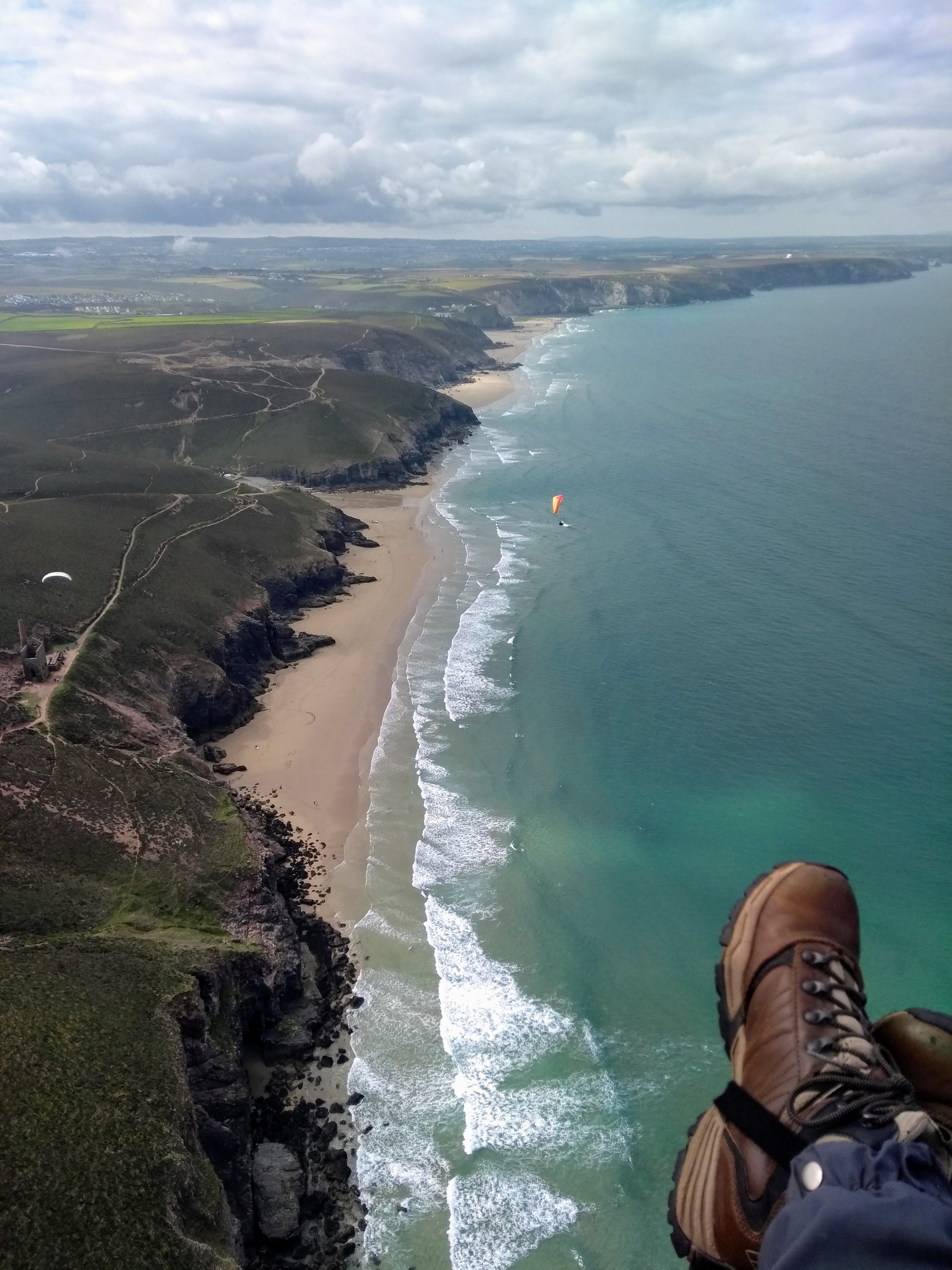
Here to promote, facilitate and protect the flying activities of our members and visiting flyers the KHPA is a friendly club with its origins going back to 1975. We have a variety of sites for varying wind directions and pilot abilities from low coastal dunes to high rugged cliffs providing all year round flying.
Registered with the UK National body for the sport, the British Hang Gliding & Paragliding Association (BHPA) as a coaching and recreational club we are non commercial. We appreciate the support and generosity of the those that enable us to fly from the sites they control and as such we make regular donations to charities nominated by them.
Alongside of negotiating and administering flying sites we can also offer pilot development through coaching and a social side at our monthly meetings . New members of all levels of experience are welcome both local and visiting,
Become a member
By becoming a KHPA member you are not only supporting the club in its work, you benefit from :-
access to all KHPA negotiated flying sites (some are members only)
monthly meetings
KHPA monthly bulletin
ability to partake in the KHPA XC League
local advice and guidance
access to all KHPA Telegram groups
input into KHPA running and decision making
ability to join the KHPA committee
Our sites
-
What should we know about the services you provide? Better descriptions result in more sales.
-
What should we know about the services you provide? Better descriptions result in more sales.

-
What should we know about the services you provide? Better descriptions result in more sales.
-
What should we know about the services you provide? Better descriptions result in more sales.

-
What should we know about the services you provide? Better descriptions result in more sales.
-
What should we know about the services you provide? Better descriptions result in more sales.